ASF Home Page | STEP | Software Info |
By subtracting two signals, you generate an interference pattern. By subtracting the phases of two co-registered SAR images, you generate an interferogram.
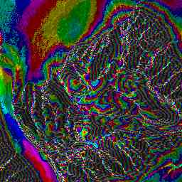
Interferograms show differences in phase. This phase difference is the result of a path length difference; the path length difference can be caused by elevation difference, motion, or deformation.
Hence, we can use interferograms to derive accurate elevation maps, monitor small motions, and detect tiny deformations.
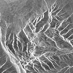
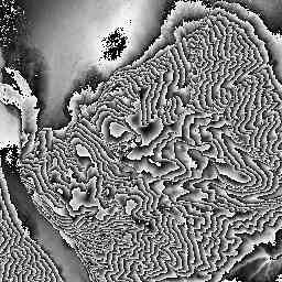
We often display interferograms by showing the phase difference as color, and the SAR amplitude as brightness. Thus
|
+ | |
= | |
| SAR Amplitude (0..300) | + | Phase Difference (-pi..pi) | = | Interferogram |
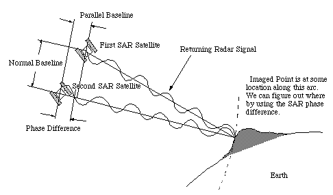
The phase of the above interferogram shows the topography of the imaged
mountain. We can convert phase into elevation if the two satellites
have some distance, or spatial baseline
between them: